Wheels, Keels, and Words
Wheels, Keels, and Words
Level: Moderate: Day 4 – Follow-up activity alternative
Time: 40 minutes
turnpike, stock certificate
Activities:
Give the students five to ten minutes to read and take notes for a presentation on their topics. The students will become the teachers who will present and answer questions on their topics.
Pass out copies of the other materials to groups of students. Ask the students to analyze the material for about five minutes. On the board, create a web about what concerns Isaiah Thomas might have had with the effect of transportation on business. They should include: conditions of roads; travel by foot, horse, or wagon/stagecoach only; turnpikes; low number of roads in existence; cost of postage per mile, and the time it took for things to be delivered.
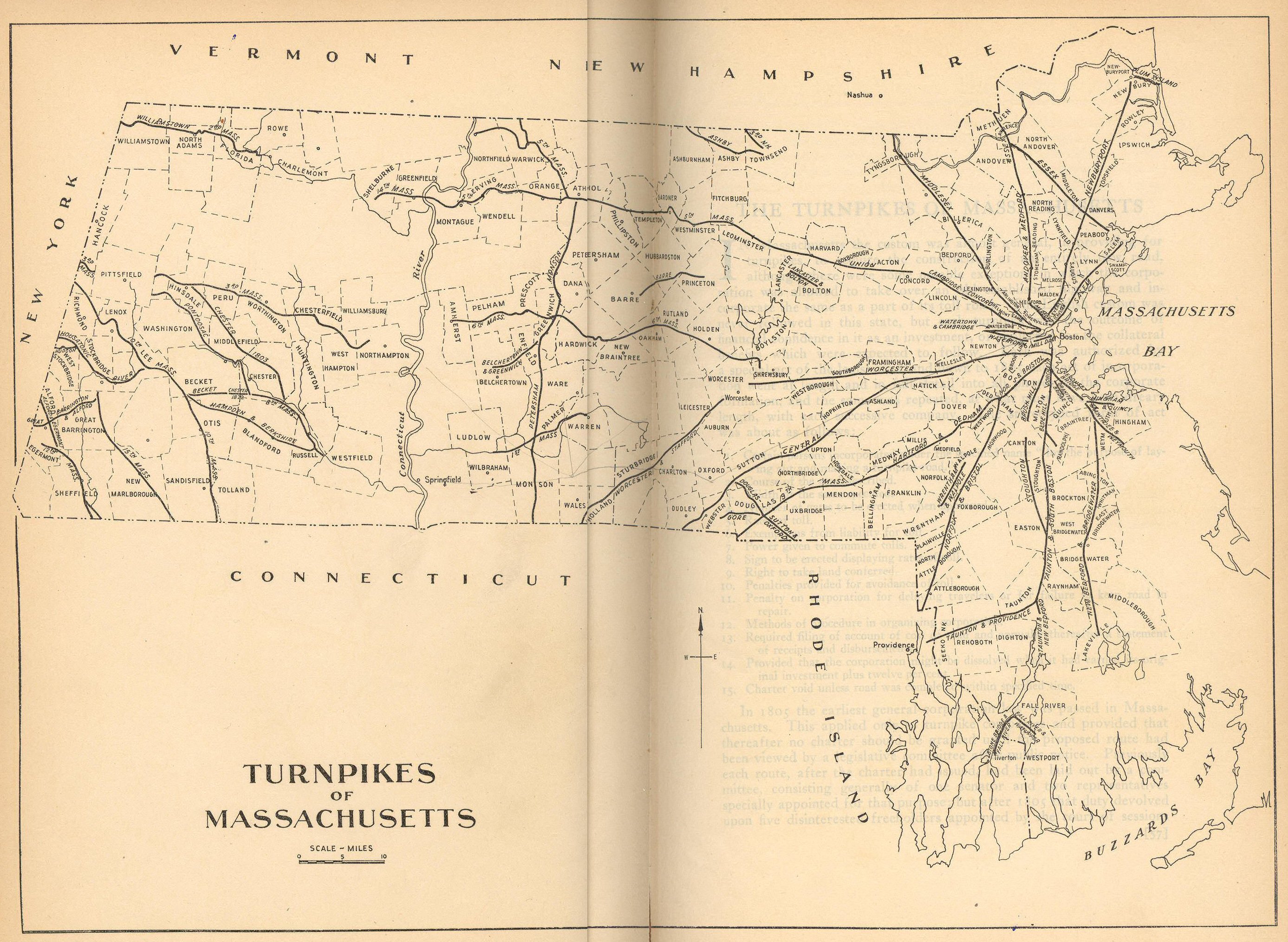
Ask the students what they know about the Worcester Turnpike from the materials. Was this an important road? What road did Isaiah refer to this as in his presentation to us? What turnpikes do we have left in Massachusetts, and why have we not gotten rid of turnpikes for good?
Using the map of Massachusetts Turnpikes, ask the students to answer the following questions: What is the scale on the map equivalent to? How many miles is it from Boston to Worcester on the Worcester Turnpike? Using the Taunton & Providence, the Taunton & South Boston, and the Newburyport turnpikes, how many miles will you travel to go from Providence to Newburyport? If you traveled from Attleborough to Concord, what turnpikes would you take? Where are most of the turnpikes leaving from and why?
Write a diary/journal entry about what it would be like to travel from Boston to Worcester on the Worcester Turnpike. Remind students to use all of the information that was discussed in class and that they saw in the materials.
Field trip to the Museum of Transportation, Brookline, MA.